Recently I found myself needing to go to Florida for a wedding. We were going down mid week, and coming back on a Sunday, which meant some of my runs for the week were going to be down there. Not a problem, as long I could get out into the trails. I haven’t been to Florida in a number of years, but as I remember it, they do love their concrete sidewalks. I am never find of doing 30-40 miles on concrete. While asphalt is a little bit better, trails are much preferred.
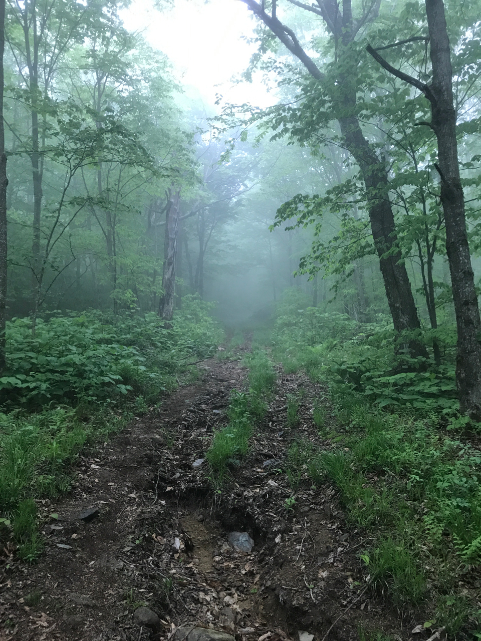
I’ve run trails in the northeast for years now, in national parks, state parks, town lands, and private reservations. I’ve run mostly in Massachusetts, but also New Hampshire, Maine, and Vermont. There are some basics that I’ve picked up: most trails are blazed or marked in some regular fashion. A good park maintains its information kiosks with trail maps, and there’s a fair amount of waste collection. While broken bottles and remnants of fires are almost a given in more populated wooded areas, giant slabs of trash aren’t so common.
Before we left the Boston area I made sure to research some trail areas around metro-Orlando. Two caught my eye: Wekiwa Springs State Park and Little Big Econ Forest. There were only going to be two days where I could get out running trails, the third day I would suck it up and run the concrete sidewalks of the hotel/corporate park location we’d be staying at.
Day one of trail running:
The plan was to leave our friend’s place on the coast of Florida, head to Orlando, drop off my fiancé at the hotel as she had wedding planning things to do with the wedding party she was in, and then I could drive out to Little Big Econ for a few hours running. Wekiwa was tempting, but a bit further out than I really had time for.
I’m sure this plan would have worked out had it not been for a kink in the morning when I promptly lost my wallet. After searching for what seemed to be an eternity, we managed to find it and then were able to head out. However since I now had less time to spend getting to a good trail, I researched and found a much closer alternative–Hal Scott Preserve. Through the miracles of the Internet, I was able to find a trail map that identified three blazed trails, mileages of each, and an appropriate parking area. Feeling confident, I headed over.
Off the highway, and off of a smaller city road, I found a small sign marking the entrance of the “parking area.” A dirt road led into a green area, and circled around a small clearing. At the far end there was a stack of empty pallets–there was no trail head kiosk, and no sign of life. There wasn’t even a sign telling visitors to keep valuables out of sight in the vehicles.
I sat in this parking area for a few minutes, alone, looking around a bit for any hint of a trail that went into the wilderness, but found nothing. So I went back to the Internet. Looked up Little Big Econ’s location. During the search I found something called the Florida National Scenic Trail–looked to be something like the Bay Circuit Trail. This also happened to be on the way up to Little Big Econ.
Okay! Back on road, heading to a new destination. After some more city driving, and flipping off someone who didn’t properly exercise her turn signal, I arrived at the Florida Trail parking lot. Pulled in, and found nothing that showed me the way to the trail. Looked around a bit again, and decided to not waste more time, and drove on to Little Big Econ.
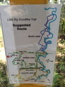
The map I found for this area showed three entrances, one of which had a ranger station. The first entrance I came to was the Jones East Trail head, with 3 obvious trails, and a kiosk with a map. But I decided to drive a bit further to find this ranger station. Found a second parking area, which I drove into. But as I entered I could feel the front of the car sink into the ground a bit–and not knowing how the rental would do in mud, I kept moving and got the car out of there. Not seeing a ranger station here, I drove on but found nothing else. Weird! Turned around, headed back to the Jones Area Lot.
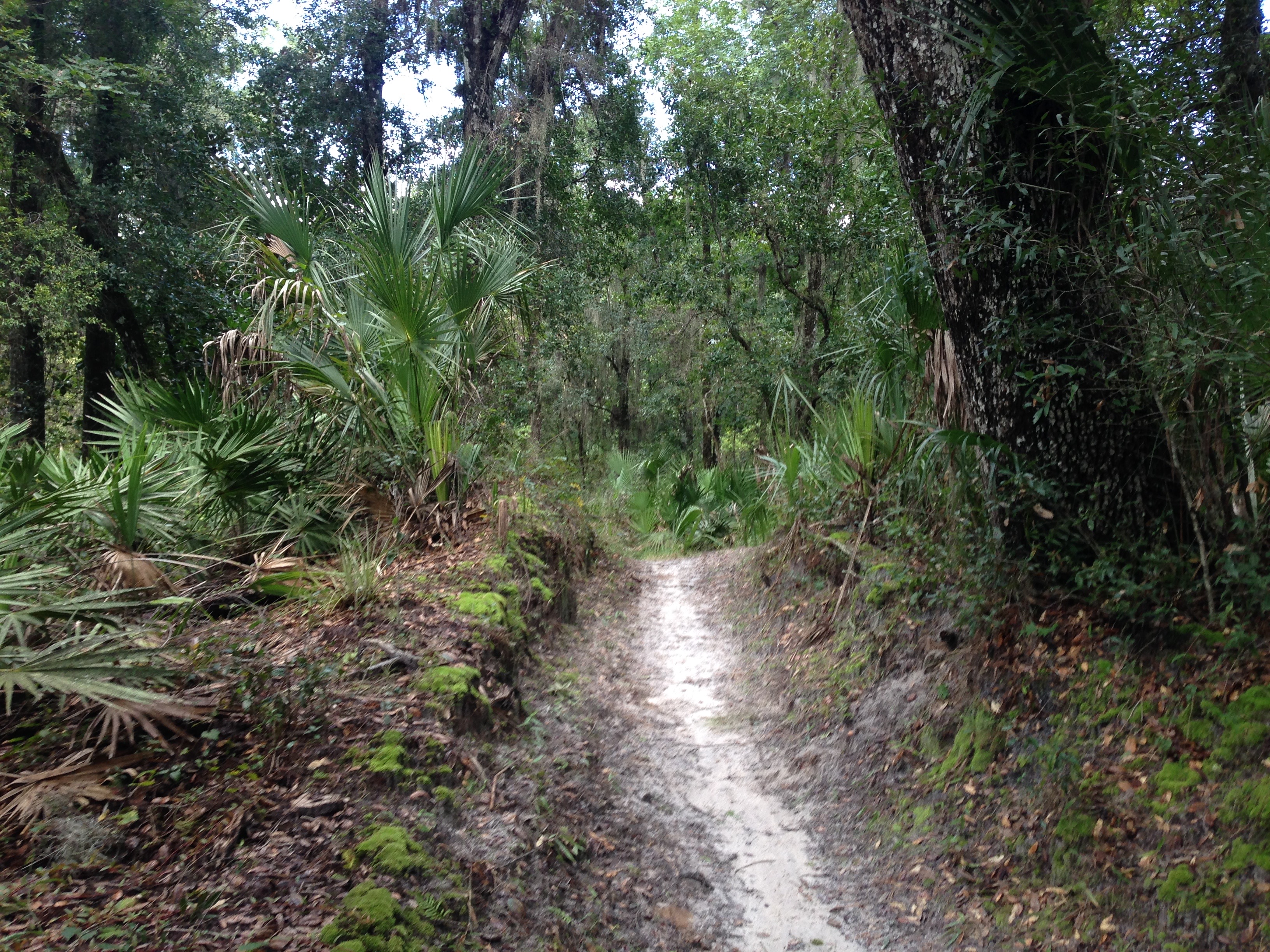
Departing from my car at Jones, I headed into the trail system with my Nathan pack filled with water. My GPS app would track my route, and was fairly sure I wouldn’t get lost. The trails were narrow single track, and very twisty. Judging by the tire tracks on the ground, I guessed these were created for the cyclist. The trails were well marked, with small maps at some of the major junctions. The remainder of the junctions were marked with names, numbers, and colour of the trail one was following. This was beautiful!

Everything was going great on this trail until I started hearing big sounds in the swamp forest around me. I knew to expect alligators and bears, but wondered if the sounds I was hearing was from either of those creatures. I remembered then that there are also panthers that live in Florida.
There’s no seeing through the dense forest, and after hearing many unknown sounds, I decided to head back to the car. Changing the plan, I decided to go back and find that Florida trail, at least it would be on something wider. I left Little Big Econ, never having seen another person, even though there were four other vehicles in the lot.
Returning to the Florida Trail parking lot, I realized there was a rear section from which the trail could be found. This trail went from here, north into Little Big Econ again. I set off, and found it to be very pleasant. There were definitely some creepy sections on this trail, where the forest crept in close to you, but otherwise it was very quiet and scenic.
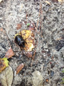
I just kept heading straight until I recognized the Little Big Econ trail markers, and was stopped by the Econlockhatchee River. Since fording a river that was possibly filled with Alligators, was not what I had in mind, I turned around and headed back. Along the way I could hear shotgun blasts in the distance. Thankfully I was looking down occasionally as I almost stepped on a stag beetle on my way back.
While I didn’t get the total miles I wanted, I did run out of water at the end of the second run. So it was time to go home (hotel).
Running day two:
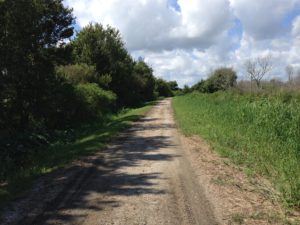
Not wanting a repeat of finding small trails and creepy forests, I opted on finding something wider. I came upon the Apopka Loop Trail (ALT) which looked interesting. A wide dirt trail along the 50 square-mile Lake Apopka. I left the hotel armed with my Nathan pack, and a bunch of Tailwind added to the water bladder. I knew the heat and humidity would be high today, and needed to to keep my body well hydrated and balanced.
The online reviews talked about the trail being very scenic, used by many bikers and hikers. Bathrooms and info kiosks at a few areas on the trail, and at the terminals. I found the trail head easily, just off the highway. The bathrooms turned out to be sub par as many hornets had made their home in the structure. As I walked over to the trail head kiosk, I nearly went face first into a very scary spider.

After telling myself not to walk near anything, I decided on a nice slow pace to my run. Being a humid day, I didn’t need to break any records. The plan was to go out 10 miles, and back–a 20 mile round trip. The ALT had markers every half mile in increments of 5, therefore one mile equalled 10, mile and half equalled 15, two miles was 20, etc. I had hoped then to get to 100 (10 miles), before turning back.
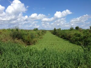
Starting out I saw my first cyclist, who waved as he pedaled by swiftly. A second cyclist appeared in the distance within a few minutes. As he passed, he warned me of the bellowing gators up ahead of me. The trail curved around a bit, with large swamps on each side, and the sound of Alligators bellowing their deep sounds filled the air. While none were present on the trails, I knew to be cautious through this and other parts. Signs attached to the trail marker posts warned of the dangers of feeding alligators.
Some sounds similar to what I heard:
Soon the trail popped out along Lake Apopka, and the are became very humid. I stuck to the middle of the wide trail, and I did an alternating run/walk for many miles. The trail was fairly desolate, and boring. The scenery was mile after mile of swamps and tall grass, and occasion there would be a side road leading to a farm or something.
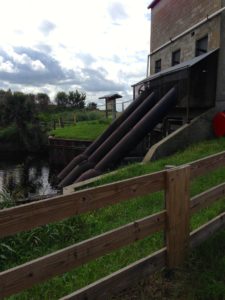
At around marker 30 (mile 3), I could see the outline of the structure ahead of me. This first attraction was the Historic Pump House at marker 40 (mile 4), and since there isn’t much else on this side of the Lake, it was easy to pick out. Within the last half mile I saw two more cyclists, both friendly.
The pump house looked to be an aging structure, with three large pipes coming out the back end. I guessed that the pumps were used to pump water into the old fields for irrigation purposes. There was an informational kiosk there, but unfortunately it was home to many hornets.
I passed marker 40, and continued down the trail. The day grew hotter, and I could tell I was going through more water than I had anticipated. The water/Tailwind combination was helping keep me upright and moving, but I knew I had passed my halfway point in the water bladder by marker 60 (6.0 miles). By this point my T-shirt was well soaked also. On the parts of the trail where I walked, I would roll up the shirt a bit, to get air on my skin, but then let it fall when I got back to running.
Eventually the trail turned right, and headed inland for a bit. As soon as it turned, the humidity died down a bit, and stayed this way as the trail went around a small canal. Once getting past marker 75 (7.5 miles), I decided to turn back. At the rate I was drinking water, I had a feeling I would most likely run out with about 2 miles to the car. While not ideal, I figured I could walk two miles without water–and then refill at the water fountain near the car.
The trip back was going to be tough. I was quite tired from the heat and humidity. Sweat was pouring off me everywhere, and the water ran low. I told myself to keep focusing on the task at hand, and went over the tricks in my head to help keep me on track. A few times I thought about ways I could get back quicker, but there was no shortcut. the best way back to civilization was down the trail that I came. This is a familiar topic in my head, and an interest of mine. I sometimes want to find an easy way out, but then have to convince myself that the normal/right way really isn’t that difficult. As so many other things, it is a skill that needs constant work.
On parts that I walked, I definitely could hear swarms of some type of insect in the swamps. At one point I walked past a tree, and saw a raccoon hanging out on an upper crutch. I was surprised to see him up there, guess he was trying to wait out the heat. Aside from insects and a raccoon, one guy in a car passed me on the trail–I believe he was an inspector of some sort. Also there were some aircraft flying low over the various swamps. I’m sure they saw the one guy out on the trail, running and walking.
As I expected, I ran out of water at around marker 15 (1.5 miles), and walked the last bit of the trail so as not to pass out before getting back. At the end I checked the weather–97 degrees with 80% humidity!
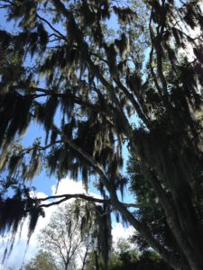
Some very cool moss/lichen hanging from the trees provided much needed shade.


I enjoyed this trail more than the last, but both trails were very sub-par to what I was expecting. The lack of proper trail markings, upkeep, and info was really irritating. Perhaps I either have, or need, high(er) standards.