We took a sojourn on the trails of Mount Greylock this past weekend, myself and three friends. One of my cohorts, Chris, is a new ultra runner like myself and I knew would have no problem on the mountain. The second person, Josh, we’ve gone on trail outings in the past. Anna, our third runner is fairly new to trails, but always loves a challenge. This would be my sixth trail excursion since the beginning of 2013. Last year we did a similar trip to Mount Greylock around this time of the year. We didn’t know what to expect at that time, but found the trails were heavily covered in snow, and the trip to near the top was very very cold.
Mount Greylock did not disappoint this year either. We set out hoping to do 12 to 15 miles, depending on the snow situation. This year we started from one of the northern most points of Mount Greylock. Starting down the Bellows Pipe Trail we found a nice wide fire road type trail, with about three or four inches of snow. Everything around was beautifully blanketed with snow. Once in awhile a stream would cross the trail, which was warm enough to melt the snow. The sounds of flowing water became a wonderful backdrop for our journey into the wilderness. The Bellows Pipe Trail was probably the best way to start out, as it was relatively flat with very few sections of uphills. This allowed us to run for quite a while before having to do major stops or uphill walking. There have been previous times when we’ve done trail outings where we immediately find an uphill section, and having to stop so soon after starting has been very demoralizing. At least it has been to me.
Several of the stream crossings on this section proved to be a bit of a challenge for some of us, however I went through most of them even stepping right into the water. The VIbrams that I had been wearing were the winter/waterproof version. At a few points it was tough to tell whether we were actually following the trail, or just following the stream bed. Markings of this trail are nearly nonexistent.
After 3 miles, the Bellows Pipe Trail takes a sharp right turn and goes past the Bellows Pipe shelter. As we took the turn and approached the shelter we could hear several voices. There was a group of four friends hanging out at the shelter. They welcomed us to hang out with them for a few minutes. In speaking with them we learned that they do their own sort of trail hikes and overnight camping on Mount Greylock often. Sometimes when you’re approaching four guys in the woods, you don’t know what to expect. They could be very macho type guys, or rednecks, but I was happy to see that these guys were neither. They were very respectful, and very easy-going. We stood around chatting for a little bit about the trail, trekking in the winter, and doing things outdoors that we obviously love.
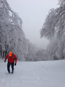
They wished us well, and directed us back onto the trail. The Bellows Pipe Trail became a gradual uphill climb. We were able to run for awhile until it turned into a steeper grade. I had taken my hiking poles out when we left the car, and while I really didn’t need them for the first 3 miles, I definitely needed them for this steady uphill. At times the incline of the path, and the slippery nature of the snow, meant we had to walk crossing one foot over the other—so that we wouldn’t slide off the trail. For the next 2.5 km (1.6 mi), or thereabouts, we climbed 400 m (1312 ft). A very confused skier passed us on our way up, probably trying to figure out why anyone would climb up a ski slope without skis, or even snowshoes. The track upward was a difficult climb, at several times there were places where the terrain looked to shoot near straight up. I’ve had to climb steep rock faces before, but nothing quite like this. Some of the sections seemed steeper than my trip up Mount Washington.
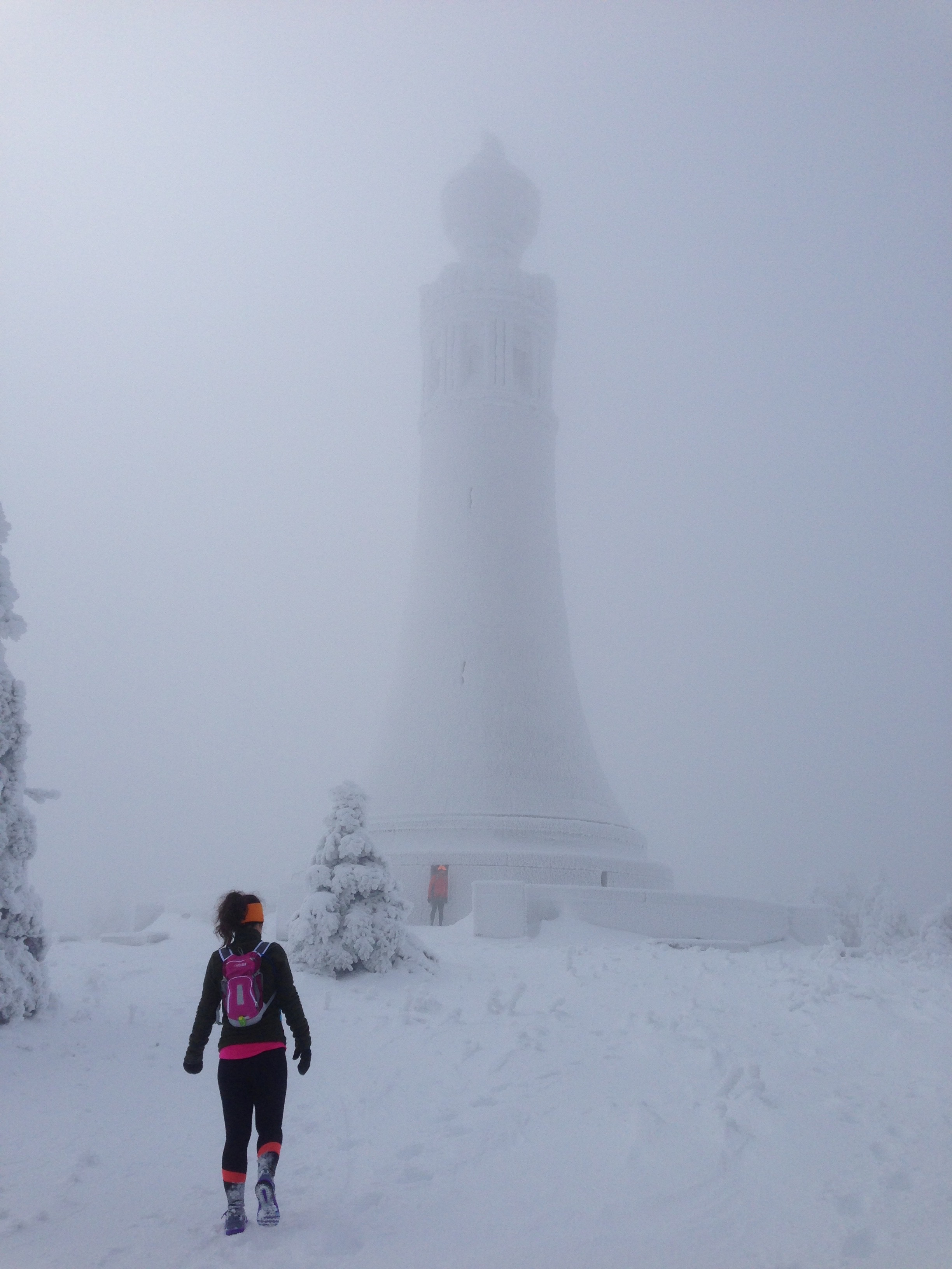
This whole area near the top looked to have been hit by an ice storm. Every single branch, and twig, and needle was covered in ice and snow crystals. The views and scenery were spectacular as everything had a coating of white! At the very top was the Veterans War Memorial Tower, which was also coated in ice and snow. As the sky was a perpetual gray color, the tower and sky almost melded together, making for wonderful pictures! At one point of the trail the top of the tower was just barely visible through the bleakness of the sky, it was an eerie site, but beautiful nonetheless.
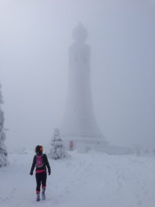
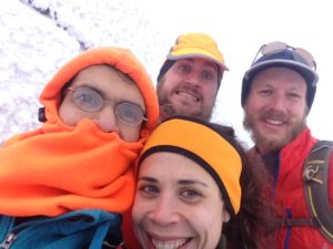
After a quick, cold run around the base of the tower, and a selfie, we headed back down the trail to the road. Upon reaching the road we decided to make a change in our running plans. Originally we were to take the AT to Mount Williams, and then around and back to the car. However after a confab, we opted on taking the road back. This was probably the best idea given that the time was already past 13:30, and we really want it to get back before the sun started going down (15:30-16:00). The parts of the AT that we had seen were covered in 12+ inches of snow. The road however looked only have 4 inches at the most.
Before setting off, and Anna grabbed her snow cleats, and I bundled up with a windbreaker/rain jacket. I had remembered taking this road up last year, and how windy and cold it was at certain points. The road essentially hugs the side of the mountain, and there were scenic vistas along the way which allowed blasts of cold air to hit the road.
We headed off, with Anna and Chris out front, and Josh and I leap frogging in the back. While I would’ve preferred to take a trail back, the road had its own challenges. Below our feet we could see tracks of skiers and snowmobiles. The tracks from the snowmobiles provided a firm surface to run on, however there was a blanket of snow on top of that which made it very difficult to keep a firm grip.
At the start of our trail outing Anna had it sent to me that she would be afraid she was going to be in the back, holding everyone up. During this last bit, while we were all tired I didn’t see her much because she was able to rocket down the road ahead of all of us.
There were several points during this mainly downhill course that I had to stop to walk. The snow-running made any forward movement very difficult, even downhill—we may as well of been going uphill on a dry road. Although at one point on one particular downhill section there was a strong blast of cold air coming from a clearing up ahead. I really wanted to stop and walk, as my legs were very tired. But I knew that if I stopped that cold air would be pulling the life from me. I knew I had to push through and get past the clearing back under the tree canopy. I saw Josh ahead of me running, which pushed me to keep up with him. I’m glad I did, the air warmed up a bit after getting past vista.
The final downhill section had several hairpin turns within the last couple of miles. The parking lot would be up soon and I was a bit saddened, because I knew our adventure was almost over. It isn’t often that I can get together with a few friends and go on an adventure such as running up a snow covered mountain. I kept running, not seeing any of my friends at this point, but knowing I would soon. Finally a clearing appeared up ahead, and my friends, and the car warming up. Overall the entire journey took us five hours, and we covered 11.5 miles.
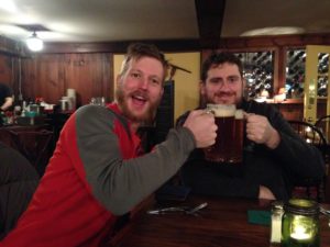
The evening held a good dinner, cheap drinks, and eventually a hilarious game of Cards Against Humanity.
On a personal note I was happy to find that neither my knee nor my left hip cause me any problems during the day. These were both areas that cost me issues during my last ultra, and have thrown a wrench into my recovery and eventual training.
Total miles: 18.5 km (11.5 mi)
Ascent: 700 meters (2296′)
Descent: 750 meters (2460′)
Snow amount at base: 4″
Snow amount at the top: 12+”